Berrien County park officials considering creation of linear park
Published 4:31 pm Sunday, May 6, 2018
BERRIEN COUNTY — With plans to connect Indiana and Michigan communities through the Indiana-Michigan River Valley Trail, county officials across the region are becoming inspired by the potential to bring cities together through interconnected trails and parks.
Berrien County is no exception.
Park Director Brian Bailey said the county is currently in preliminary stages of developing a linear park that will connect the county’s seven parks through trails and roadways.
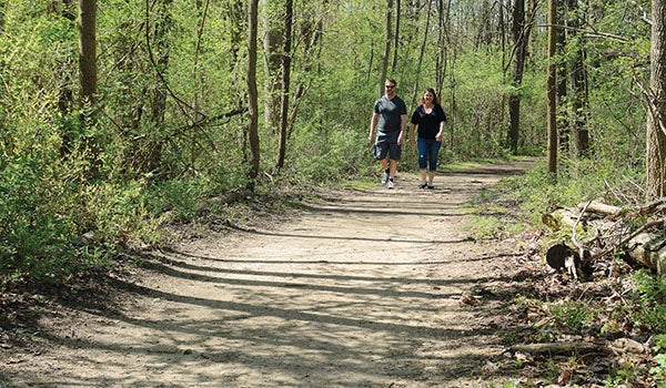
Whether an avid biker or hiker, the linear park would allow for people to appreciate more of southwest Michigan’s countryside, Bailey said.
“Trails are a big item right now in the state of Michigan and in the country,” Bailey said. “The public is asking for trails. It’s one of the things that Natural Resources Trust Fund [is making] one of their priorities.”
While a linear park would offer longer hiking and biking excursions with a more varied landscape, Bailey said he could also see a linear park being well used during the winter months, when local skiers are looking for a place to put in some miles.
A prospective plan for the linear park shows a path that borders the Berrien County perimeter, wrapping from Watervliet Park down to Niles to U.S. 12 and north to Coloma Road. A section of the trail would also cut across the county from east of Berrien Springs to Bridgman.
In Niles Township, Berrien County Commissioner Jim Curran said one proposed example would be connecting the trail in south Niles Township to the linear trail, so someone could take the township trail directly to Madeline Bertrand County Park.
Bailey said the idea to create a linear park was spurred by planned fall construction on Red Arrow Highway. An approximately 2-mile stretch of highway south of Bridgman to Browntown Road will be resurfaced.
Because it would be ideal to combine work on a linear trail with a road resurfacing project, the construction started a conversation between the Berrien County Road Department and the park’s department about the idea of creating an approximate 13-mile trail near the highway. The trail would be called the Red Arrow Highway Pathway and would stretch from Galien River County Park to Bridgman.
The parks department has hired Landscape Architects and Planners, Inc. as consultants to create a master plan for the Red Arrow Highway Path. The firm will help to assess ideal spots for trailheads, rest stops and restrooms. Planning is expected to conclude for the project in October.
If the Red Arrow Highway Path is completed, Bailey said this would serve as phase one for the larger vision of creating a county-wide linear park. Eventually, the county parks could even be connected to the Marquette Greenway, a renowned trail that terminates in New Buffalo and stretches through Indiana to Chicago, Bailey said.
Plans for the county-wide linear park are still in the beginning stages and many details still need to be worked out. The park board discussed the vision late last month. At this time, Bailey does not know time approximately what a project like this would cost. As the county continues to develop the project and definitive costs are decided, the parks department will look for opportunities to apply for grants or find partners with other municipalities for funding.
“Connecting all the county parks is a long-range plan,” Bailey said. “We have to start somewhere.”
Bailey said he does not have an immediate time frame for the county-wide linear park at this stage of the planning. It is also unknown just how many miles of trail that a linear park would amount to.
For now though, it is a vision the Bailey said the parks department hopes to flesh out, because it would feature some of Berrien County’s best natural assets.
“Berrien County is home to … a variety of agriculture and different amenities from the rivers that are here and the dunes,” Bailey said. “With the [flower] blossoms that are happening right now, why not get out and enjoy it?”