Corridor can be Michigan gateway
Published 8:26 pm Monday, September 17, 2012
Highly commercialized, the four-lane, 4.5-mile 11th Street corridor moves 22,000 vehicles daily between Niles and Indiana.

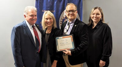
Shelley Klug
It offers a convenient route for tourists, shoppers, students and workers traveling between Niles and South Bend-Mishawaka.
“There is incredible potential for this corridor to become a scenic, welcoming and commercially prosperous gateway to Michigan,” Shelley Klug, executive director of Southwestern Michigan Economic Growth Alliance, told Niles-Buchanan Rotary Club Monday noon at Riverfront Cafe. “With all of the vacant properties, paradoxically connected to popular destinations, this is the best possible time to capitalize on an amazing opportunity to rebuild the corridor to its greatest potential.”
The corridor parallels the developing Indiana-Michigan River Valley Trail.
It begins at Oak Street, continues south through Niles Township, which begins at Fort Street, and, at the Indiana state line, becomes Highway 933. The route continues south past the University of Notre Dame into downtown South Bend.
“What do we call it? Even the person who did the market strategy insisted on calling it ‘Highway 51.’ There are too many curb cuts,” Klug said, citing 28 to 69 driveways per mile.
Klug also pointed to confusing signs and a lack of pedestrian-friendly amenities.
“We’re scheduling meetings to determine our next steps,” said Klug, explaining that the purpose of the 11th Street corridor project is to create a cohesive plan that will improve development opportunities.
“The plan focuses on identifying and maximizing existing resources, reusing and redeveloping deteriorating commercial properties, providing public green space and recreational opportunities and incorporating design guidelines to enhance the corridor’s ‘gateway to Pure Michigan’ location,” Klug said.
She compared the vision to Michigan City, Ind., Canton, Mich., Woodward Avenue in Detroit and Benton Harbor’s arts district.
A grant through Partnerships for Change (PfC) Sustainable Communities, a multijurisdictional community planning and technical assistance program that fosters cooperation between cities, townships and villages, sounded attractive.
PfC helps local governments collaborate on land-use policies and programs that contribute to preserving cultural and natural resources.
Since 2004, 38 communities and 180 local governments participated in the program developed by Michigan Municipal League, Michigan Townships Association, the Michigan Association of Planning, Michigan State University Extension and the Land Information Access Association.
An application submitted in October 2010 yielded a technical assistance grant,
which means the granting organization provides staff hours, she said.
“That was the best part,” Klug said. “As the local facilitating organization, we brought the public together to provide input. Through the generosity of our community foundations, we were able to provide required matching funds without spending any taxpayer dollars.”
The plan completed in March contains maps detailing issues, concerns, assets and amenities. Yet to come are a fleshed-out action plan and land-use policies, guidelines
The city declared a moratorium on new development in hopes of getting new guidelines in place to “maximize work already done and to start seeing positive results quickly. This is at a crossroads because we want to do it right, in a manner we can afford.”
The plan is online at www.southwesternalliance.org/nilescommunity.asp.