Fort: enough fireplaces; we need walls
Published 10:13 am Thursday, February 4, 2010

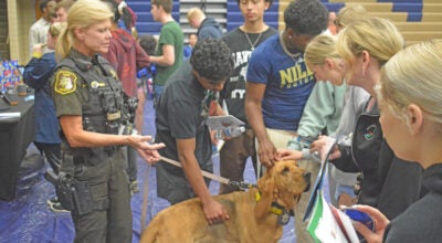
Western Michigan University archaeological graduate students Erin Claussen, Ian Kerr and Amanda Brooks led off the Museum at Southwestern Michigan College Museum spring lecture series Wednesday night with a program on the Fort St. Joseph project in Niles. Erin is from Champaign-Urbana, Ill.; Ian, Massachusetts; and Amanda, a Pennsylvania native from Monroe. 2010 camp dates are: July 26-30 for ages 16 and up; Aug. 2-6 for grades 6-9; and Aug. 9-13 for teachers for continuing education credit. (The Daily News/John Eby)
By JOHN EBY
Dowagiac Daily News
“We kind of joke that we have more fireplaces than we know what to do with,” Western Michigan University graduate student Erin Claussen said of ongoing field work along the St. Joseph River in Niles where Fort St. Joseph was rediscovered in 1998.
By that, Claussen, of Champaign-Urbana, Ill., means the Fort St. Joseph Archaeological Project, a collaboration between WMU and Niles, “We have no idea where the walls are that go along with the fireplaces” to establish a perimeter.
Since the site is submerged except when “dewatered” for a series of three archaeological summer camps, there has been the suspicion that some of the fort site extends beneath the dammed river and an adjacent city dump.
“Understanding more about the layout continues to be a goal of each dig,” Claussen said as she, Ian Kerr and Amanda Brooks led off The Museum at Southwestern Michigan College spring lecture series Wednesday night.
The next program at 6:30 p.m. March 3 features SMC ceramics instructor Sherrie Styx on “Stained Glass Windows in Dowagiac.”
Excavation for artifacts occurs within six feet of the river in “units” measuring one meter square or one meter by two meters on a grid system established with a transit device.
Students dig in five-centimeter increments, or “levels,” while taking copious notes.
“One of the most crucial aspects of the archaeology at Fort St. Joseph is the careful taking of notes,” Kerr said.
“Through notes, drawings and photographs, relationships of artifacts to one another and the structural features help archaeologists to delineate activity areas within the site.”
Changes in soil colors also help them “make sense of the physical spatial layout of the fort site and what kind of structures were there,” Kerr said.
Beneath the 20-centimeter alluvial layer of debris and tree roots deposited by the river, diggers reach the “plow zone” from when the site was farmed.
Excavation is carried out by a combination of “shovel skimming” and troweling. Soil is washed through eighth-inch mesh. The water driven through the screen leaves small artifacts behind for collection.
This past field season an electrical system was installed to replace a noisy Volkswagen Beetle-sized diesel pump.
“We’ve done some geophysical surveys of the ground,” Claussen continued. “The fireplaces jut out as an anomaly and that’s sort of been it. We haven’t seen any indication that there is a large stone wall. We’re leaning toward the structures were maybe a little less permanent.”
“A lot of materials, like the wood, had been carried away,” Brooks said. “The fort had kind of been deconstructed when it was abandoned” in 1913. “We’re not expecting to find too much of that material left behind.”
A WMU geography student is using GIS (Geographic Information Systems) to map the fireplaces and looking at what artifacts are found by what features.
“We’ve spent three or four years now just kind of slowly opening up units directly adjoining hearths,” Kerr said. “If you dig 20 percent of an entire site, that’s considered quite good. With our small field school, we’re not in a position to open an entire area. It’s kind of hard to visualize.”
Brooks said, “It’s also rather difficult because our site is right on the bank of the river. On the other side, about 30 feet over, is a city dump. A lot of our site is covered by the dump. We’re trying to focus on the one small area, especially after installing the dewatering system. Without finding structural remains of the walls, we don’t know if we’re inside the fort or outside.”
“There are still some sizable gaps in what we know about the spatial parameters,” Kerr said.
“It probably extends under the landfill,” Brooks said, “and maybe a mile downstream it’s dammed. That’s caused the river to become much wider than it would have been in the 18th century. We have someone at Western who goes out on the river in the winter when it’s frozen and did some radar. We did not find a lot of anomalies, so we’re kind of leaning toward the fact that, hopefully, a lot of the site is not covered by the river. There is a sandbar slightly off the bank that we’ve probed and haven’t come up with a lot of material, either. We’re hoping it doesn’t extend very far into the river.”
After completing field season, archaeologists backfill their holes, which provides security for unrecovered artifacts.
“With the transit,” Kerr said, “we know exactly where we’ve dug and can dig it back out because we put down black tarp. If we all went down their tomorrow and looked at the site, you probably would never know there’s archaeology going on there.”
Fort St. Joseph was established as a mission by French Jesuits and was one of the earliest European outposts on the North American continent.
During the first half of the 18th century, it served as a garrison and trading post that supported a commandant, 10 enlisted men, a blacksmith, a priest, an interpreter and up to 10 additional households.
“The fort was an important link in the chain of frontier settlements of New France and facilitated trade in furs between the French and Native peoples,” Kerr explained. “For almost 80 years, French priests, enlisted men and traders lived in close contact with Native groups,” including Potawatomi and Miami Indian tribes.
In 1761, during the French and Indian War, the fort came under British control. Where the French curried alliances, the British were “domineering,” with little regard for establishing the close-knit relationships the French had.
As a result, in 1763, Ottawa Band supporters attacked Fort St. Joseph in the Great Lakes region to roust the British.
The fort was not re-garrisoned, although a number of French fur traders remained in the area.
In 1781, a small contingent of French and Natives, supported by the Spanish governor, raided the fort and claimed it for Spain – for about a day, but long enough to give Niles its nickname, CIty of Four Flags.
“After this episode, the fort was largely abandoned,” Kerr said, “although trade likely continued. Fort St. Joseph lived in the memory of the town of Niles, Mich., for well over 200 years after its abandonment in 1781. The fact that it had existed nearby was certainly not forgotten, as evidenced by public monuments,” such as the boulder placed in 1913.
“Niles’ nickname reflects the legacy of the fort as well,” Kerr said.